
En bref
- Apalachicola National Forest is Florida’s largest national forest unit, with 576,062 National Forest System acres inside a 635,019-acre total unit area.
- The red-cockaded woodpecker is the species that most shapes management here, because its pine habitat drives ESA and fire decisions.
- Two wilderness areas, no designated wild and scenic river, and the 1999 forest plan frame current management.
- Visitor use runs through Forest Service rules, Florida wildlife rules, and current road and closure conditions.
- Florida
- state
- 576,062 NFS acres
- largest national forest in Florida
- Red-cockaded woodpecker
- ESA-listed focal species
- Longleaf pine, hardwood hammock, wetlands
- main habitat frame
- 1999
- current forest plan for the National Forests in Florida
Collection path: Southern National Forests > National Forests in Florida > Apalachicola National Forest.
Apalachicola National Forest sits in the Florida Panhandle, west of Tallahassee, in a mix of longleaf pine, hardwood hammock, lakes, swamps, creeks, and river corridors. The public image is often about camping, a picnic, or trail access, but the legal story is narrower and more useful: a federal land unit, a listed bird, fire-managed pine habitat, and a planning record that still matters today. If you are trying to explore the forest on a map, the first thing to make clear is that recreation and conservation run on the same ground.
This page reflects official sources checked in October 2026. The latest legal change it reflects is the October 25, 2024 Federal Register final rule that reclassified the red-cockaded woodpecker as threatened, effective November 25, 2024. The planning baseline remains the 1999 forest plan for the National Forests in Florida.
Key facts
We use the same grid across the Southern National Forests collection. If an official source does not confirm a value for this fiche, the table says not known instead of guessing from a recreation page.
| Property | Value | Source |
|---|---|---|
| State | Florida | U.S. Forest Service unit pages, checked October 2026 |
| Acres | 576,062 National Forest System acres; 635,019 total acres | USDA Forest Service Land Areas Report, FY 2023 |
| Established | May 13, 1936 | Proclamation 2169, 49 Stat. 3516 |
| Ranger districts | Apalachicola Ranger District and Wakulla Ranger District | U.S. Forest Service unit materials, checked October 2026 |
| Wilderness areas | Bradwell Bay Wilderness; Mud Swamp/New River Wilderness | Forest Service wilderness materials, checked October 2026 |
| Wild and scenic rivers | None listed for Apalachicola National Forest | National Wild and Scenic Rivers System official list, checked October 2026 |
| ESA-listed species | Red-cockaded woodpecker, threatened | U.S. Fish and Wildlife Service; 89 Fed. Reg. 85294, October 25, 2024 |
| Current forest plan | 1999 Revised Land and Resource Management Plan for the National Forests in Florida | U.S. Forest Service forest plan documents, January 1999 |
| Recent projects or litigation | not known | Forest Service project pages and public legal records, checked October 2026 |
Two values do most of the work here. The acreage shows why Apalachicola is the largest Florida unit in the National Forest System. The 1999 plan matters for a different reason. It still frames broad management direction unless a later amendment or project decision changes a specific instruction.
Why this forest stands out in Florida
Size is the obvious starting point, but it is not the whole point. Apalachicola is the largest national forest unit in Florida, and that gives the Forest Service a large federal block in the Panhandle where pine habitat, wetland systems, roads, and recreation all sit inside one management frame. Compared with Ocala or Osceola, the forest feels less like a single-use recreation landscape and more like a working conservation unit with several overlapping pressures.
That overlap matters because the same acres have to carry different legal tasks at once. The Forest Service manages habitat, access, fire, and timber direction under one plan. State wildlife rules can govern hunting and fishing. Wilderness rules can tighten what is allowed in a specific corner of the map. That is why a forest fiche like this needs more than a scenic description.
The comparison should stay precise. “Largest national forest in Florida” means largest among the National Forest System units in Florida, not largest public land area in the state overall. State forests, wildlife management areas, parks, refuges, and private conservation lands follow different authorities. Apalachicola also sits in a broader wildlife management context, but it remains a federal forest first.
The red-cockaded woodpecker connection
For Apalachicola, the species that matters most is the red-cockaded woodpecker. Forest Service and U.S. Fish and Wildlife Service materials place the forest inside the species’ recovery story, and that is not a side note. The bird was listed under the Endangered Species Act and later reclassified as threatened in a final rule published in the Federal Register on October 25, 2024, effective November 25, 2024. Downlisting changed the regulatory status, not the fact that the species remains listed.
That status has a practical effect. Under 16 U.S.C. § 1536(a)(2), federal agencies must ensure that actions they authorize, fund, or carry out are not likely to jeopardize a listed species or destroy or adversely modify designated critical habitat. For a Forest Service project in suitable habitat, that can mean consultation, review, or both. The legal question is not abstract. It follows the habitat map.
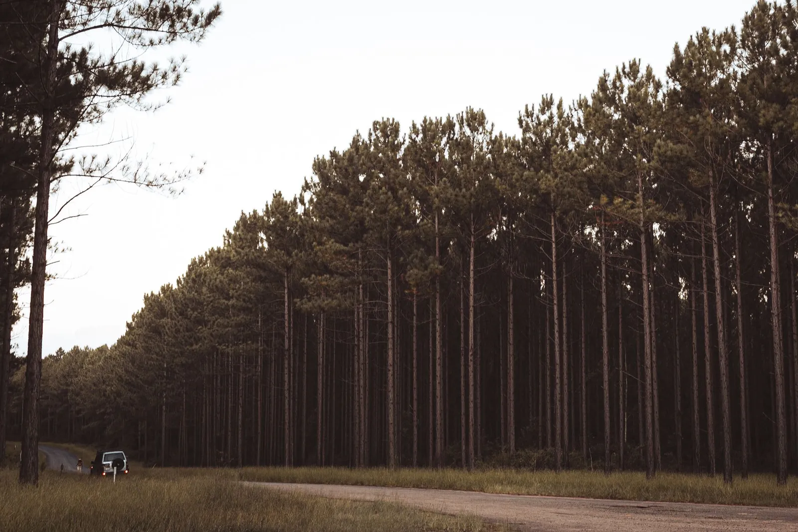
The habitat itself explains the management logic. The woodpecker uses open pine systems, including longleaf, loblolly, slash, and other pines, with living pines for cavity trees and enough fire or fire-like management to keep the understory from closing in. That is why prescribed fire, thinning, and vegetation work are not minor tools here. They sit in the same decision space as wildlife protection. If you miss that, you miss the forest’s real legal profile.
Landscape, water, and wilderness
Apalachicola is not just pine. Forest Service materials describe longleaf pine, slash pine, pine flatwoods, hardwood hammock, forested wetlands, swamps, bogs, lakes, ponds, creeks, and river corridors. That mix explains why visitor pages talk about fishing, boating, scenic driving, and trails, while conservation sources keep coming back to habitat structure. You also see why a weekend visit can feel very different from one trailhead or one creek crossing to the next.
The forest’s water story reaches beyond the woods. It sits inland from saltwater beaches and islands on the Gulf side, but that coastal setting still shapes how people plan a day trip, a picnic, or a boat outing. Freshwater lakes and streams inside the forest follow one set of conditions; nearby coastal recreation follows another. For safety information, road status, and seasonal alerts, the official Forest Service page and the Florida Fish and Wildlife Conservation Commission, or FWC, are the right places to find current guidance. If you want a permit question answered, or you need to find a campground or a primitive site, start with the district office before you get there.
Wilderness areas
Bradwell Bay Wilderness and Mud Swamp/New River Wilderness are the two wilderness areas listed for the forest. They sit under the Wilderness Act, 16 U.S.C. § 1131 et seq., which changes the tone of management immediately. Mechanized and motorized uses are limited there, subject to the statute and site-specific rules. A map line can change the legal answer faster than a casual visitor expects.
Rivers and recreation waters
Several named waters shape how people experience the forest, including the Sopchoppy River, Ochlockonee River, New River, and Apalachicola River, plus recreation spots such as Wright Lake, Camel Lake Recreation Area, and Silver Lake. But a named river is not the same thing as a federal wild and scenic river designation. The National Wild and Scenic Rivers System list checked for this page does not include a designated wild and scenic river for Apalachicola National Forest.
Visitor use and access
Visitor use is broad, but it never overrides current conditions. Camping, trails, fishing, hunting, boating, wildlife viewing, and scenic driving are all part of the forest experience, yet each one sits under a different rule set depending on the site and season. Forest Service recreation pages, maps, alerts, and closure notices control current access.
Camping and trail access
Camping comes in more than one form, and the distinction matters. Wright Lake and Camel Lake Recreation Area appear in official materials as developed or semi-developed recreation settings. Dispersed camping is a different arrangement, with different expectations about facilities, fees, vehicle access, and stay limits. If you are looking for a campground for a night or two, or a place to make a short weekend trip, the current Forest Service page beats any third-party trip writeup. The same is true for a picnic area or a boat landing.
The same caution applies to trails. The Florida National Scenic Trail runs through the forest, and wet ground changes the answer faster than people expect. Bradwell Bay is a good example. A trail segment can look fine on a static map and still be a poor choice once water levels rise or a road closes. Current maps and notices matter more than memory.
Fishing, hunting, and driving
Fishing and hunting sit in the broader Florida wildlife management context. The Florida Fish and Wildlife Conservation Commission controls licenses, seasons, quotas, and area rules. This page does not tell you what you may do on a given day. It only states the legal frame: state wildlife rules may apply, and Forest Service site rules may apply too.
Driving through the forest is possible on public roads and on designated forest roads, but the motor vehicle use map decides where motorized travel is allowed. That is the document that settles the access question, not a social post and not a recollection from last season.
Current plan, projects, and legal context
The current planning baseline is the 1999 Revised Land and Resource Management Plan for the National Forests in Florida. That plan governs Apalachicola unless a later amendment, project decision, or replacement plan changes a specific direction. Do not treat the plan as a relic. It still does real work. It sets broad management direction, then project-level decisions fill in the details.
That distinction matters when you look at fire, timber, road, or recreation projects. Some actions move only through Forest Service planning and site rules. Others also trigger NEPA, 42 U.S.C. § 4332(2)(C), and some require ESA consultation when listed species may be affected. For Apalachicola, the ESA issue is not theoretical. The red-cockaded woodpecker and its pine habitat sit right in the middle of the forest’s management logic.
The recent-projects and litigation field is marked not known. That is deliberate. We are not forcing a headline into the record just to make the page look busier. The forest is defined by its unit records, its plan, its wilderness areas, and its species question. A one-off project notice should not be treated as the whole story.
Nearby and related
- Ocala National Forest
Florida sister forest in the same National Forests in Florida system.
- Conecuh National Forest
Gulf Coastal Plain comparison point for longleaf pine and Southern forest management.
Use those neighboring fiches for comparison, not for travel rankings. The shared grid lets you compare state, acres, wilderness, rivers, listed species, forest plan, and dated management context without mixing national forests with state parks, wildlife refuges, or private destinations.
Primary sources
- Table 3 - Areas by Region, Land Areas of the National Forest System, FY 2023, USDA Forest Service.
- Proclamation 2169: Apalachicola National Forest, Florida, Office of the Federal Register / GovInfo.
- Revised Land and Resource Management Plan for National Forests in Florida, U.S. Forest Service, Southern Region.
- Endangered and Threatened Wildlife and Plants; Reclassification of the Red-Cockaded Woodpecker From Endangered to Threatened With a Section 4(d) Rule, 89 FR 85294, U.S. Fish and Wildlife Service.
- National Forests in Florida - Home, U.S. Forest Service.
- Find a River, National Wild and Scenic Rivers System / Rivers.gov.
Sources accessed October 24, 2026.