
In brief
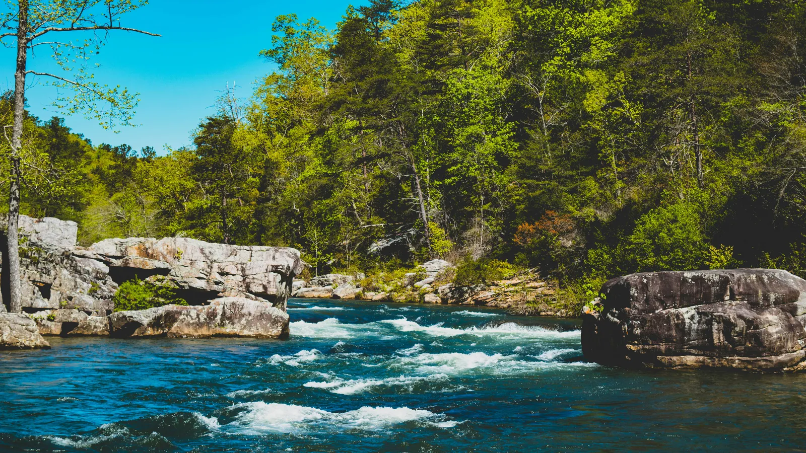
William B. Bankhead National Forest is a northwestern Alabama national forest with 182,015 acres of National Forest System land, Sipsey Wilderness, and Sipsey Fork of the West Fork, identified in this source review as Alabama’s only National Wild and Scenic River.
Official profile
William B. Bankhead National Forest is one of the four national forests in Alabama. The Forest Service places Bankhead in northwestern Alabama, in Lawrence, Winston, and Franklin Counties. Its legal profile turns on two designations: a congressionally designated wilderness area and a river segment in the National Wild and Scenic Rivers System.
This page follows the Southern National Forests profile grid: state, acreage, counties, administrative unit, ranger district, wilderness, wild and scenic river, forest plan, species records, and recent actions. This review reflects Forest Service pages, the USDA Forest Service Land Areas Report, the National Wild and Scenic Rivers System listing, and planning records checked in October 2026.
| Property | Value | Source |
|---|---|---|
| Official name | William B. Bankhead National Forest | Forest Service and Land Areas Report records, checked October 2026 |
| State | Alabama | Forest Service and Land Areas Report records, checked October 2026 |
| Region | Northwestern Alabama | Forest Service records, checked October 2026 |
| Counties | Lawrence, Winston, and Franklin Counties | Forest Service planning and unit records, checked October 2026 |
| National Forest System acres | 182,015 acres | USDA Forest Service Land Areas Report, checked October 2026 |
| Administrative unit | National Forests in Alabama | Forest Service records, checked October 2026 |
| Ranger district | Bankhead Ranger District | Forest Service office and unit records, checked October 2026 |
| Established | not known | Primary-source date not confirmed in this source review |
| Wilderness areas | Sipsey Wilderness | Forest Service wilderness records, checked October 2026 |
| Wild and scenic rivers | Sipsey Fork of the West Fork | National Wild and Scenic Rivers System listing and Forest Service records, checked October 2026 |
| Current forest plan | Revised Land and Resource Management Plan for the National Forests in Alabama, 2004 | Forest Service planning records, checked October 2026 |
| ESA-listed species noted in forest records | not known | No Bankhead-specific ESA species list was confirmed in this source review |
| Recent projects or litigation | not known | No dated Bankhead-specific project decision or recent litigation record was confirmed in this source review |
| Latest source check | October 2026 | Field & Statute source review |
The acreage row uses the Land Areas Report value, not a rounded recreation description. Two entries carry most of the legal weight: Sipsey Wilderness and Sipsey Fork of the West Fork. One brings wilderness management rules. The other brings Wild and Scenic Rivers Act protections. They are not the same designation, and the Forest Service has to account for both.
Where Bankhead sits in Alabama
Bankhead National Forest is in northwestern Alabama. Forest Service planning records identify Lawrence, Franklin, and Winston Counties for the Bankhead National Forest. For the larger state context, see the National Forests of Alabama page.
Double Springs is the community most often associated with the Bankhead Ranger District in public descriptions. This page does not give driving directions, trail access, or route advice, because those details belong in current Forest Service maps and road notices.
Bankhead is part of the National Forests in Alabama administrative unit. That unit also includes Talladega National Forest, Conecuh National Forest, and Tuskegee National Forest. The Land Areas Report lists Alabama’s four national forests with 673,199 acres of National Forest System land. Bankhead is one of those forests. It is not a state park, county preserve, private recreation area, or national wildlife refuge.
That distinction matters. A national forest is managed by the U.S. Forest Service, within the U.S. Department of Agriculture, under federal law, the forest plan, and project-level decisions.
Why Sipsey Wilderness and Sipsey Fork matter
Bankhead’s profile starts with Sipsey Wilderness and Sipsey Fork of the West Fork. Search traffic usually arrives through trails, camping, hunting, fishing, horseback riding, waterfalls, and creek scenery. Those uses matter, but they do not explain why this forest stands out in federal land records.
Under the Wilderness Act of 1964, wilderness is a congressionally designated area managed to preserve wilderness character. In plain English, that means the Forest Service is expected to keep development low, limit motorized use, and avoid actions that would damage the undeveloped condition of the area, subject to the statute and site-specific rules.
Under the Wild and Scenic Rivers Act of 1968, a designated river segment is protected for its free-flowing condition and its outstandingly remarkable values. The National Wild and Scenic Rivers System listing identifies the official designation as the Sipsey Fork of the West Fork, and the source review identifies it as Alabama’s only National Wild and Scenic River.
Those designations do not turn Bankhead into a closed preserve. Hiking, paddling, fishing, scenery, wildlife viewing, and solitude still belong in the public story. What changes is the management baseline. In Sipsey Wilderness, wilderness character is part of the legal standard. Along Sipsey Fork, protected river values enter the decision record.
We would put it more bluntly: if you only read the visitor language, you miss the legal reason this forest is on the map.
Forest plan and current management
The current forest-plan record used for this page is the January 2004 Revised Land and Resource Management Plan for the National Forests in Alabama. A forest plan is not a permit, a trail notice, or a campground rule. It sets broad program-level direction for management of the land and its resources.
For Bankhead, the plan is the starting point, not the finish line. A prescribed fire project, recreation-site change, trail action, wildlife habitat project, watershed project, or timber proposal would normally appear in Forest Service project records. This review did not confirm a dated Bankhead-specific project decision from primary records during the October 2026 check, so the table keeps that field at “not known.”
The same discipline applies to litigation. No recent Bankhead-specific litigation was identified in the primary-source review for this page as of October 2026. That does not mean no dispute exists anywhere around the forest. It means this profile did not confirm a recent court record tied to Bankhead in the sources reviewed.
For legal statements on this page, the primary source controls: the statute, the Forest Service plan, the official unit page, the Land Areas Report, the National Wild and Scenic Rivers System listing, and dated project records.
Recreation context, without pretending this is a trail guide
People search for Bankhead National Forest, Alabama because they want outdoor details: trails, campground names, camping, hunting, fishing, horseback riding, swimming, boating, picnic areas, creek routes, canyon scenery, bluffs, waterfalls, and lake access. Forest Service recreation materials for Bankhead identify developed recreation areas, including Houston Recreation Area, Corinth Recreation Area, and Clear Creek Recreation Area.
Those names are useful, but they do not answer the profile question. A trail guide tells you where to walk. An entity profile tells you what the forest is, who manages it, what protected areas sit inside it, and which plan governs the unit.
Current recreation details change faster than a forest profile. Fees, permits, fire restrictions, hunting rules, campground operations, road conditions, flood damage, temporary closures, and office contact information depend on current Forest Service notices and other official information. That is why this page keeps to the stable framework.
If you need a map, phone number, road notice, or office contact, use current Forest Service media and unit information rather than a static profile page.
Compared with the other Alabama national forests
Bankhead sits inside Alabama’s four-forest federal system. The Land Areas Report lists Alabama’s four national forests with 673,199 acres of National Forest System land. Bankhead’s 182,015 acres make it a substantial part of that system, but not the whole story.
| Forest | State | Acres | Wilderness | Wild and scenic river |
|---|---|---|---|---|
| William B. Bankhead | Alabama | 182,015 acres | Sipsey Wilderness | Sipsey Fork of the West Fork |
| Talladega National Forest | Alabama | not known | not known | not known |
| Conecuh National Forest | Alabama | not known | not known | not known |
| Tuskegee National Forest | Alabama | not known | not known | not known |
The comparison stays conservative on purpose. We do not fill the table with numbers from tourism pages or loose web summaries. For this page, the confirmed acreage is Bankhead’s acreage, and the confirmed protected features are Sipsey Wilderness and Sipsey Fork of the West Fork.
That still tells you something useful. Bankhead is the Alabama forest in this source review where wilderness and wild and scenic river status sit at the center of the profile.
Questions about Bankhead National Forest
Questions about Bankhead National Forest
Where is William B. Bankhead National Forest?
William B. Bankhead National Forest is in northwestern Alabama. Forest Service planning records identify Lawrence, Franklin, and Winston Counties for the Bankhead National Forest.
What is Bankhead National Forest known for?
In recreation searches, Bankhead is known for trails, creeks, camping, waterfalls, horseback riding, hunting, and fishing. In this profile, its defining features are Sipsey Wilderness and Sipsey Fork of the West Fork.
Is Sipsey Fork a wild and scenic river?
Yes. The National Wild and Scenic Rivers System listing used for this page identifies the official designation as the Sipsey Fork of the West Fork, and the source review identifies it as Alabama’s only National Wild and Scenic River.
How many acres is Bankhead National Forest?
The Land Areas Report value used for this page is 182,015 acres of National Forest System land.
Are there wolves in Bankhead National Forest?
This page does not verify current wolf presence from the Forest Service, the ESA, or other primary sources used in the October 2026 review. We do not treat unsourced wildlife claims as forest facts.
Nearby and related pages
This Bankhead page belongs to the Southern National Forests collection. The most direct Alabama comparison page in the collection is Talladega National Forest, because it sits in the same National Forests in Alabama administrative unit. A separate wilderness explainer helps when you need the difference between designated wilderness, proposed wilderness, and a wilderness study area.
Primary sources
- FS-383: Land Areas of the National Forest System, As of September 30, 2024, USDA Forest Service.
- Revised Land and Resource Management Plan: National Forests in Alabama, USDA Forest Service, Southern Region.
- National Forests in Alabama: Wilderness, USDA Forest Service.
- Sipsey Fork of the West Fork River, Rivers.gov / Interagency Wild & Scenic Rivers Coordinating Council.
- National Forests in Alabama: Recreation, USDA Forest Service.
- Motor Vehicle Use Map: Bankhead National Forest, USDA Forest Service.
Sources accessed October 24, 2026.