
En bref
Pisgah National Forest is a federal national forest in western North Carolina, managed by the U.S. Forest Service, not a national park. The Forest Service approved the Nantahala and Pisgah National Forests Land Management Plan in a 2023 Record of Decision; a March 31, 2026 federal court order vacated the plan’s biological opinion and remanded it to the U.S. Fish and Wildlife Service. The forest covers 512,758 acres and is administered through three ranger districts. Wilderness, wild and scenic river protection, and Endangered Species Act review use different legal tools. Current access questions depend on Forest Service alerts, orders, and site notices.
- North Carolina
- state
- 512,758 acres
- USDA Forest Service Land Areas Report
- 2023
- forest plan Record of Decision
- 3 ranger districts
- Appalachian, Grandfather, Pisgah
Core facts for Pisgah National Forest
Pisgah National Forest is a federal land unit, not a park and not one recreation site. Its legal guide is a land management plan, followed by project-level decisions for roads, trails, campgrounds, timber, prescribed fire, and restoration work.
The table keeps to Forest Service sources, the USDA Forest Service Land Areas Report, and the 2026 federal court order affecting the plan’s Endangered Species Act record. When a forest-wide value is not stated clearly in those sources, the table says so.
| Property | Value | Source basis |
|---|---|---|
| State | North Carolina | Forest Service unit materials |
| Managing agency | U.S. Forest Service, U.S. Department of Agriculture | 2023 plan notice and unit materials |
| Acres | 512,758 acres | USDA Forest Service Land Areas Report |
| Established | 1916 | Forest Service materials for National Forests in North Carolina |
| Ranger districts | Appalachian, Grandfather, Pisgah | Forest Service transportation analysis and unit materials |
| Designated wilderness areas named in the sources used here | Linville Gorge Wilderness, Shining Rock Wilderness, Middle Prong Wilderness | Forest Service wilderness and planning materials |
| Wilderness study areas on Pisgah lands named in the plan materials | Craggy Mountain, Harper Creek, Lost Cove | Forest Service plan materials |
| Wild and scenic rivers | Wilson Creek; Horsepasture River | National Wild and Scenic Rivers System and Forest Service materials |
| ESA-listed species | Not known as a single fixed forest-wide list in the sources used for this page | ESA consultation framework, planning records, and 2026 court order |
| Forest plan record | Nantahala and Pisgah National Forests Land Management Plan, approved in a 2023 Record of Decision | Forest Service 2023 Record of Decision notice |
| Recent dated legal record | March 31, 2026 order vacating and remanding the biological opinion for the revised forest plan | U.S. District Court for the Western District of North Carolina |
Where Pisgah sits in western North Carolina
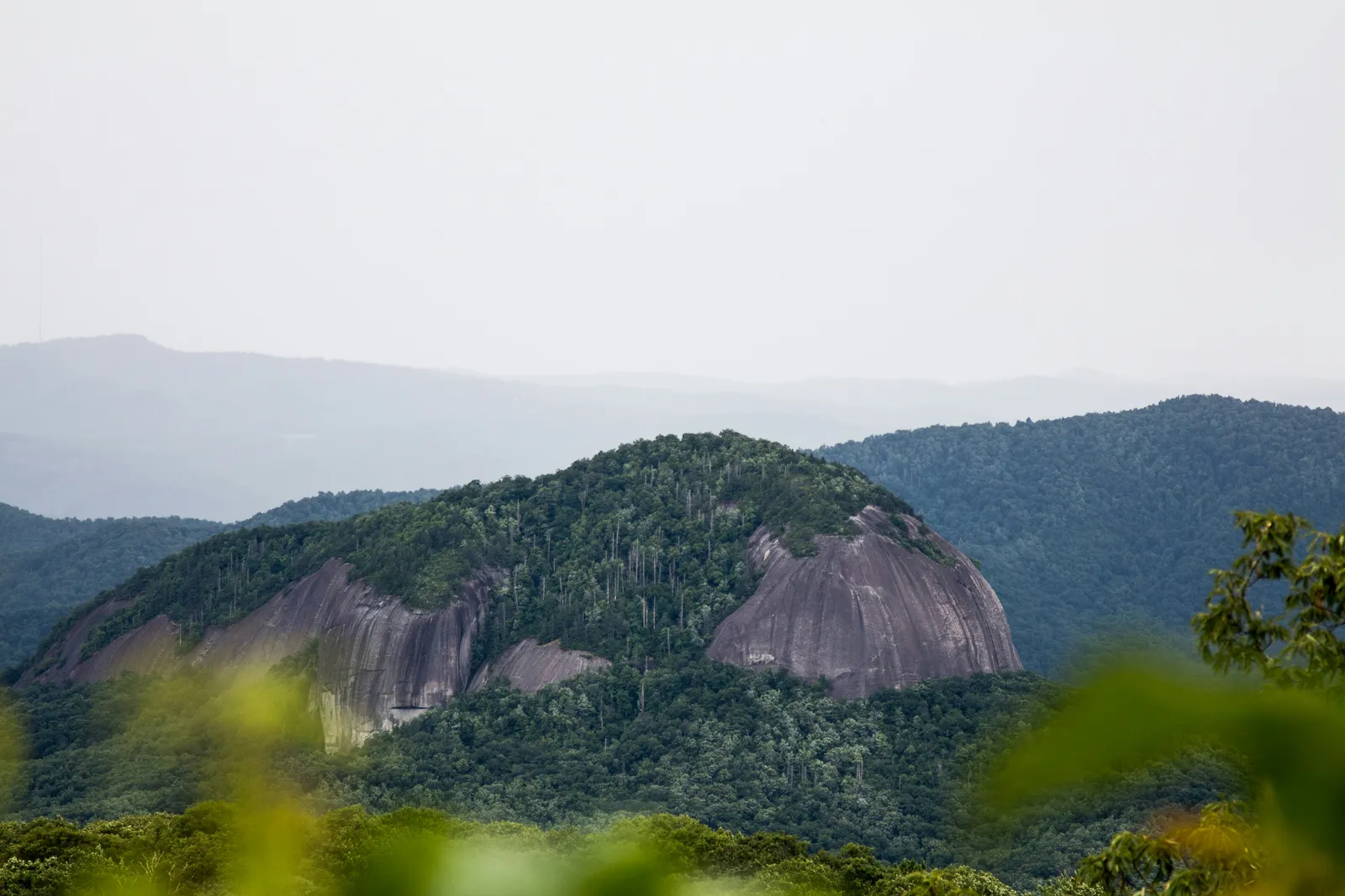
Pisgah sits in the Blue Ridge Mountains of western North Carolina. Asheville is the city many people use as a regional reference point. Brevard is the more immediate gateway for much of the Pisgah Ranger District, including the Davidson River corridor, Looking Glass Rock, Sliding Rock, Bent Creek, North Mills River, Lake Powhatan, and the Cradle of Forestry area.
Those names matter, but they do not define the whole forest. Pisgah is not one compact block with one gate and one set of rules. It is a federal forest spread across mountain terrain, with different places carrying different access, use, and management questions.
Some visitors know it through the Blue Ridge Parkway. Others come for hiking, fishing, mountain biking, horseback riding, camping, or a scenic drive to a trailhead. The legal status of the land does not change with the season.
Ranger districts and named places
A ranger district is the Forest Service’s field-level unit. It is not the same thing as a county, wilderness area, or recreation site. District staff handle road and trail issues, permits, local notices, project work, and day-to-day administration for their part of the forest.
The Pisgah Ranger District is the one most people mean when they ask about Brevard, Davidson River, Looking Glass Rock, Sliding Rock, Bent Creek, North Mills River, or Lake Powhatan. It is closely tied to camping, hiking, biking, and horseback riding, but a district is still an office and management area, not a tourism unit.
The Grandfather Ranger District covers Pisgah lands farther north, including Linville Gorge and Wilson Creek. The Appalachian Ranger District covers other northern mountain lands in the National Forests in North Carolina system.
If you are trying to locate a trail, campground, river access, or closure notice, the district name usually matters more than the forest name alone.
Wilderness, rivers, and protected resources
Under the Wilderness Act of 1964, wilderness designation limits motorized and mechanized use and sets a stricter preservation standard. The Forest Service sources used here identify Linville Gorge Wilderness, Shining Rock Wilderness, and Middle Prong Wilderness as designated wilderness areas associated with Pisgah National Forest.
Craggy Mountain, Harper Creek, and Lost Cove appear in the 2023 plan materials as wilderness study areas. That is not the same legal category as designated wilderness.
Wilson Creek and Horsepasture River are the wild and scenic river entries confirmed for Pisgah in the sources used here. Under the Wild and Scenic Rivers Act, designated river segments are managed to protect the values named in each designation record. The Wilson Creek designation reaches from the headwaters below Calloway Peak to the confluence with the Johns River. The Horsepasture designation covers a 4.2-mile segment managed within Pisgah National Forest.
For endangered species, the key point is practical. Under 16 U.S.C. § 1536(a)(2), a federal agency must consult when an action may affect listed species or critical habitat. That is why ESA effects show up in project records, not as one fixed forest-wide list. A timber sale, road project, trail change, prescribed fire, or watershed project can trigger review if it may affect protected species or habitat.
A wilderness designation does not answer every access question. A river designation does not settle every use issue along a watershed. ESA review follows the federal action and its consultation record.
The 2023 Nantahala-Pisgah Forest Plan
The Forest Service approved the Nantahala and Pisgah National Forests Land Management Plan in a 2023 Record of Decision. This page also reflects the March 31, 2026 federal court order that vacated and remanded the biological opinion for the revised plan.
A forest plan sets the framework. It states desired conditions, objectives, standards, guidelines, management areas, and monitoring direction. In plain terms, it tells the Forest Service what the agency is aiming for and what limits later actions must respect.
The plan does not approve every later action. A road project still needs its own decision. A trail change still needs its own record. A timber sale, prescribed burn, campground change, or restoration project still has to fit the governing plan and go through the required process. Depending on the action, that can include NEPA review, ESA consultation, or Clean Water Act permitting.
That distinction matters on the ground. The 2023 plan changed the rulebook for the forest when the Forest Service approved it. The 2026 court order changed the legal posture of the plan’s ESA consultation record. Neither document pre-clears every future move.
How Pisgah compares with nearby national forests
Pisgah and Nantahala are neighboring national forest units in western North Carolina. They share the same 2023 Nantahala and Pisgah Land Management Plan, but they remain separate forest units.
| Comparison point | Pisgah National Forest | Reference |
|---|---|---|
| Acres | 512,758 acres | USDA Forest Service Land Areas Report |
| Relationship to 500,000 acres | 12,758 acres above 500,000 acres | Calculated from the Land Areas Report value |
| Forest plan record | 2023 Nantahala and Pisgah National Forests Land Management Plan Record of Decision | Forest Service 2023 notice |
| Recent ESA plan record | Biological opinion vacated and remanded on March 31, 2026 | U.S. District Court for the Western District of North Carolina |
| Regional neighbor | Nantahala National Forest | National Forests in North Carolina unit materials |
“More than 500,000 acres” is a fair shorthand. The Land Areas Report value is better when comparing Pisgah with nearby federal forests.
Common questions about Pisgah National Forest
What is Pisgah National Forest famous for?
It is known for hardwood forest, waterfalls, whitewater rivers, trails, Blue Ridge scenery, and the Cradle of Forestry historic site. Looking Glass Rock, Sliding Rock, Davidson River, and Linville Gorge come up often too. They are landmarks inside a larger federal forest, not separate units.
Which city is closest to Pisgah National Forest?
There is no single closest city for the whole forest. Asheville is the main regional reference point. Brevard is the more practical gateway for much of the Pisgah Ranger District and the Transylvania County side of the forest.
Is Pisgah National Forest open?
Not always in the same way, and not everywhere at once. Roads, trails, campgrounds, swimming areas, visitor centers, and offices can close because of weather, fire, construction, storm damage, seasonal rules, or a Forest Service order. Current alerts and site notices control the answer.
Do you have to pay to enter Pisgah National Forest?
There is no single entrance gate for the entire forest. Some recreation sites, campgrounds, group sites, passes, or permits may have fees or rules. The fee question is site-specific.
Sources and latest change reflected
Latest change reflected: the March 31, 2026 order in Defenders of Wildlife v. U.S. Forest Service, which vacated and remanded the biological opinion for the revised Nantahala and Pisgah forest plan. The Forest Service approved the revised plan in a 2023 Record of Decision.
Sources used: U.S. Forest Service unit and planning materials for National Forests in North Carolina, USDA Forest Service Land Areas Report materials, the Federal Register notice of the 2023 plan approval, National Wild and Scenic Rivers System materials for Wilson Creek, and the 2026 federal court order on the plan biological opinion.
Nearby and related pages
Related pages
- Nantahala National Forest: Wilderness, Rivers and the Joint Forest Plan
Neighboring forest unit with the same 2023 plan
- Southern National Forests
Collection overview for the national forests covered on this site
- South Toe River: How Protection Shows in the Public Record
How river protection appears in federal records
Primary sources
- Final Record of Decision for the National Forests in North Carolina, Federal Register / U.S. Government Publishing Office.
- Nantahala and Pisgah National Forests Revised Land and Resource Management Plan, U.S. Forest Service.
- National Forests in North Carolina, U.S. Forest Service.
- Pisgah National Forest Transportation Analysis Process Report 2012, U.S. Forest Service.
- USDA Forest Service FSGeodata Clearinghouse: Wilderness & Wild and Scenic Rivers & Wilderness Study Areas, North Carolina, U.S. Forest Service.
- Wilson Creek, National Wild and Scenic Rivers System.
Sources accessed October 24, 2026.