
This page covers the national forests in Alabama, North Carolina, and Florida as U.S. Forest Service units, not as a travel ranking. It is for readers who need a map view, a comparison table, the governing forest plan year, or a route into the forest-by-forest pages.
This draft reflects USDA Forest Service unit pages, forest plans, and Land Areas Report style acreage figures checked on October 24, 2026. It is informational only and does not give legal advice.
In brief: the Southeast forest map at a glance
- Alabama has four national forests, North Carolina has four, and Florida has three in this three-state frame.
- These are U.S. Forest Service units, not National Park Service lands or state forests.
- The table below compares acreage, wilderness, waters, listed species, and plan year.
- Alabama comes first, then North Carolina, then Florida, with one river example to show how waters fit the system.
Pages covered in this dossier
The forest pages in this set use the same grid: acreage, wilderness, waters, listed or signature species, and the governing forest plan. Alabama comes first because the main query is about national forests in Alabama. North Carolina follows because “forest service North Carolina” often mixes federal and state agencies. Florida closes the sequence with panhandle and peninsula forests.
The detailed pages are: Bankhead National Forest, Talladega National Forest, Conecuh National Forest, Tuskegee National Forest, Pisgah National Forest, Nantahala National Forest, Uwharrie National Forest, Apalachicola National Forest, Ocala National Forest, and South Toe River.
Croatan National Forest and Osceola National Forest are in the count and in the master table, although this version does not yet give each one a dedicated page.
Map view across the Southeast
Read the map as orientation, not as a field boundary map. In Alabama, the national forests run from north Alabama and the Cumberland Plateau into central Alabama and the coastal plain. In North Carolina, they stretch from the western mountains to the central Piedmont and, through Croatan, to the coastal plain. In Florida, they run from Apalachicola in the panhandle to Ocala in the peninsula and Osceola in north Florida.
National forests do not form one continuous block. For ground navigation, use the current Forest Service visitor map, district map, or motor vehicle use map.
Master table: acres, wilderness, waters, species, and plan year
This is the comparison grid for the forests covered here. Acres are rounded to avoid false precision. Plan years refer to the governing forest plan or revised plan identified in Forest Service planning materials. Where the source set did not give a comparable value, the table says not known.
| State | National forest | Acres | Wilderness areas | Major rivers or waters | Listed or signature species | Governing forest plan year | Page |
|---|---|---|---|---|---|---|---|
| Alabama | William B. Bankhead National Forest | about 182,000 | Sipsey Wilderness | Sipsey Fork, Black Warrior watershed | listed aquatic species and forest species noted in plan materials | 2004 | dedicated page |
| Alabama | Talladega National Forest | about 395,000 | Cheaha Wilderness, Dugger Mountain Wilderness | Talladega Creek, upland watersheds | red-cockaded woodpecker and listed species noted in plan materials | 2004 | dedicated page |
| Alabama | Conecuh National Forest | about 85,000 | none identified in this source set | Conecuh River and coastal plain waters | red-cockaded woodpecker, longleaf pine system | 2004 | dedicated page |
| Alabama | Tuskegee National Forest | about 11,000 | none identified in this source set | Uphapee Creek area waters | listed species noted in plan materials | 2004 | dedicated page |
| North Carolina | Pisgah National Forest | about 513,000 | Linville Gorge, Shining Rock, Middle Prong and other designated areas | Wilson Creek, Horsepasture River, French Broad system, South Toe River area | listed aquatic species and Appalachian forest species | 2023 | dedicated page |
| North Carolina | Nantahala National Forest | about 531,000 | Joyce Kilmer-Slickrock, Southern Nantahala and other designated areas | Nantahala, Chattooga, and Little Tennessee systems | listed aquatic species and high-elevation forest species | 2023 | dedicated page |
| North Carolina | Uwharrie National Forest | about 51,000 | Birkhead Mountains Wilderness | Uwharrie River and Yadkin Pee Dee basin waters | listed species noted in plan materials | 2012 | dedicated page |
| North Carolina | Croatan National Forest | about 160,000 | none identified in this source set | coastal plain pocosins, estuarine and wetland waters | red-cockaded woodpecker and coastal plain species | 2002 | not yet covered by a dedicated page |
| Florida | Apalachicola National Forest | about 576,000 | Bradwell Bay Wilderness, Mud Swamp/New River Wilderness | Ochlockonee, Apalachicola region waters, flatwoods wetlands | red-cockaded woodpecker, longleaf pine, and listed wetland species | 1999 | dedicated page |
| Florida | Ocala National Forest | about 383,000 | Alexander Springs, Billies Bay, Juniper Prairie, Little Lake George | springs, lakes, St. Johns basin waters | scrub, sand pine, and red-cockaded woodpecker plan context | 1999 | dedicated page |
| Florida | Osceola National Forest | about 195,000 | Big Gum Swamp Wilderness | Suwannee and St. Marys basin waters | red-cockaded woodpecker and flatwoods species | 1999 | not yet covered by a dedicated page |
The table includes Croatan and Osceola because they are official national forests in this three-state frame. Size alone tells you little. Talladega is larger than Tuskegee, but Tuskegee still sits inside the same federal land system, with Forest Service planning, maps, notices, and project records.
What “national forest” means here
A national forest is federal land managed by the United States Forest Service inside the Department of Agriculture. That is different from a national park, usually managed by the National Park Service in the Department of the Interior, and from a state forest or state park, managed under state law.
The Forest Service manages national forests for multiple uses, including recreation, timber, watershed protection, wildlife habitat, fire, roads, and restoration, as each forest plan allows. A forest plan does not decide every site-specific project. It sets the framework. Later projects, such as timber sales, road work, prescribed fire, or habitat restoration, move through the agency’s project process.
That distinction explains why “forest service North Carolina” can be confusing: the N.C. Forest Service is a state agency, while the National Forests in North Carolina are federal Forest Service units.
Alabama
Alabama’s four national forests
Alabama has four national forests: Bankhead, Talladega, Conecuh, and Tuskegee. The Forest Service presents them together as the National Forests in Alabama, with a supervisor’s office, ranger district pages, recreation information, alerts, planning documents, projects, offices, and maps.
They are not interchangeable. Bankhead is tied to the Sipsey Wilderness and the Black Warrior watershed. Talladega is the largest Alabama unit in this table. Conecuh represents the coastal plain and longleaf pine system. Tuskegee is smaller, but it remains part of the federal national forest system.
Bankhead National Forest
Bankhead National Forest, formally William B. Bankhead National Forest in many federal references, sits in north Alabama. It shows how a southern national forest can combine restoration history, wilderness, water, and recreation within one federal unit.
The Sipsey Wilderness is the main protected area reference for Bankhead. The forest also sits in the Black Warrior watershed context, which makes rivers and water quality part of the way to read the unit.
Talladega National Forest
Talladega National Forest is the largest of Alabama’s national forests by the rounded figures used here. It is also the Alabama unit where a reader quickly meets ranger district structure, because Talladega is not a single simple block on the map.
The forest includes Cheaha Wilderness and Dugger Mountain Wilderness. Its legal and ecological value comes from the overlap of upland forest, roads, water, wildlife habitat, fire, and forest plan direction.
Conecuh National Forest
Conecuh National Forest sits in south Alabama, in the coastal plain. Its signature frame is longleaf pine, fire-adapted habitat, and the species that depend on that system.
Forest Service materials for the Alabama forests identify red-cockaded woodpecker as a relevant listed species in the longleaf pine context. Conecuh is the clearest Alabama forest for that connection.
Tuskegee National Forest
Tuskegee National Forest is the smallest Alabama national forest in this table. Its size should not be used as a shortcut for significance.
Small national forests still carry the same federal land management structure: a named unit, Forest Service planning, projects, recreation rules, maps, and public notices.
North Carolina
North Carolina’s national forests and the federal Forest Service
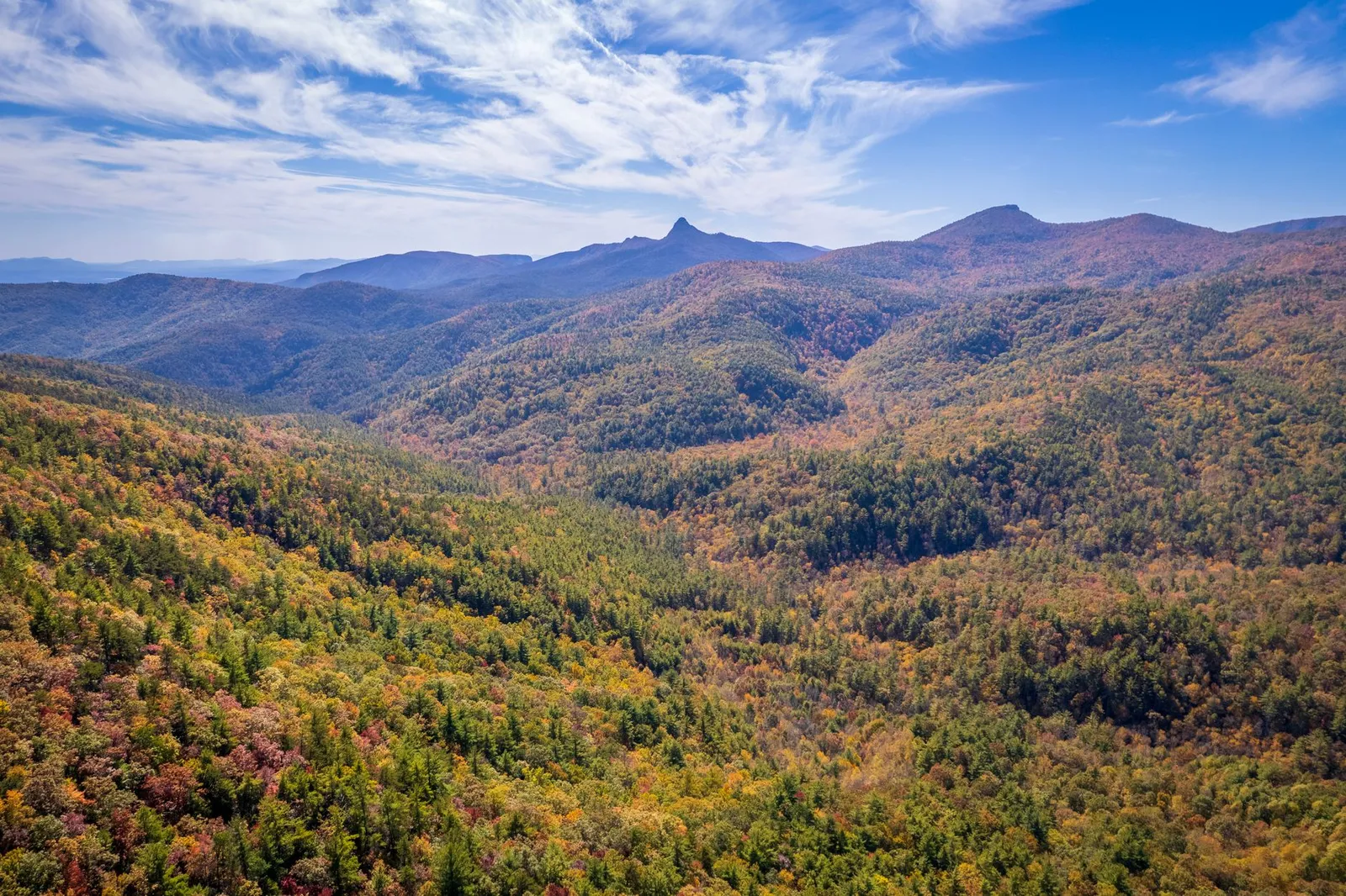
North Carolina has four national forests: Pisgah, Nantahala, Uwharrie, and Croatan. Searches for “forest service North Carolina” often mix the federal U.S. Forest Service, which manages national forests, with the N.C. Forest Service, a state agency that works on state and private forest issues.
This page set focuses on the federal units. Pisgah and Nantahala are the mountain forests most tied to western North Carolina rivers, wilderness, and the 2023 forest plan. Uwharrie is the central North Carolina national forest. Croatan belongs in the official count and the master table.
Pisgah National Forest
Pisgah National Forest sits in the mountains of western North Carolina. It is one of the central forests for understanding how Forest Service planning connects roads, trails, rivers, wilderness, listed species, and public participation.
In the common grid, Pisgah is read through its acres, mountain waters, wilderness areas, and the 2023 plan for the Nantahala and Pisgah National Forests. The South Toe River area gives this set a river-level entry into the forest.
Nantahala National Forest
Nantahala National Forest is also in western North Carolina, but it is not a duplicate of Pisgah. Its river systems, high-rainfall mountain setting, and designated areas give it a different administrative and ecological profile.
For a law and public lands reader, the question is which plan governs the unit, which waters and wilderness areas appear in the source materials, and which listed or signature species are relevant to the forest plan and later project reviews.
Uwharrie National Forest
Uwharrie National Forest sits in central North Carolina. It differs from Pisgah and Nantahala because it is not a western mountain forest and because its acreage is much smaller.
The Uwharrie page should be read for the same core questions: what the Forest Service manages, which waters are named in the source set, which wilderness area applies, which species or habitats matter, and which plan year governs the unit.
Florida
Florida’s national forests
Florida has three national forests: Apalachicola, Ocala, and Osceola. The first two have dedicated pages in this set, and Osceola appears in the master table so the state count stays complete.
Florida adds panhandle longleaf pine and wetland systems, peninsular sand pine and scrub settings, springs, flatwoods, and swamp forests. That mix matters because water, listed species, prescribed fire, and restoration often sit close together in the same management record.
Apalachicola National Forest
Apalachicola National Forest is in the Florida Panhandle and is the largest Florida unit in the rounded figures used here. Its signature context is longleaf pine, wet flatwoods, wetlands, and listed species habitat.
For this site, Apalachicola is a public lands and species case study. The forest plan, water systems, and red-cockaded woodpecker context show how federal land management, habitat restoration, and endangered species concerns meet on the ground.
Ocala National Forest
Ocala National Forest sits in peninsular Florida. Forest Service materials commonly frame it through springs, lakes, scrub, sand pine, and recreation, but this page set reads those features through the same public lands grid used for the other forests.
That means the Ocala page should answer the comparable questions first: acres, waters, wilderness, species, and the governing plan year. Recreation appears because the Forest Service manages it, not because this page is a travel guide.
South Toe River
South Toe River gives this page set a water entry rather than another administrative unit. It belongs here because rivers help explain what national forest management changes on the ground: habitat, recreation, watershed condition, roads, restoration, and project review.
In the Pisgah context, a river page can show how a reader moves from a forest-wide plan to a specific watershed.
How to read a Forest Service unit page
A Forest Service unit page is useful, but it is built for several tasks at once. Start with alerts and current conditions if you need access information for today. Use recreation pages for campgrounds, trails, permits, and visitor information. Use maps and guides for boundaries, roads, motor vehicle use, and district orientation.
For planning questions, move to planning and projects. Planning pages identify the forest plan, amendments, and sometimes monitoring reports. Project pages identify site-specific actions and the public record for those actions. Offices, contact pages, and ranger district pages help you find the right administrative unit, but this site does not reproduce office directories because they change faster than a summary page.
News, social media, video, press items, and general menus are not the source of the comparison grid here.
Why these forests matter in an environmental law site
National forests are places where public lands law becomes concrete. A forest plan sets the frame. Wilderness designations limit certain uses. Roads and timber projects raise planning and environmental review questions. Prescribed fire and longleaf pine restoration connect land management to habitat. Rivers and wetlands connect the forest to water law. Listed species connect the same ground to the Endangered Species Act.
This page does not walk through the National Environmental Policy Act or the Endangered Species Act procedure for any individual project. It gives the geographic and administrative map you need before reading those procedures.
Sources and update note
The unit names, state counts, rounded acres, wilderness references, forest plan years, and species cues in this page come from USDA Forest Service unit pages, Forest Service forest plans, and Land Areas Report style acreage sources available to the editorial file. Values were checked for this draft on October 24, 2026. Where a primary source did not give a comparable value for the common grid, the table says “not known.”
Neighboring dossiers
For the legal systems behind these forest pages, read the neighboring dossiers on Public Lands and Endangered Species. Public lands explains the Forest Service, wilderness, timber, roadless areas, and fire. Endangered species explains listing, critical habitat, consultation, and citizen enforcement in more detail.
Primary sources
- National Forests in Alabama Land and Resource Management Plan, U.S. Forest Service.
- Land Areas of the National Forest System as of September 30, 2024, U.S. Forest Service.
- National Forests in North Carolina, U.S. Forest Service.
- Final Nantahala and Pisgah National Forests Land Management Plan, U.S. Forest Service.
- Croatan National Forest Land and Resource Management Plan, U.S. Forest Service.
- National Forests in Florida - Home, U.S. Forest Service.
Sources accessed October 24, 2026.